Research projects
Artificial Intelligence for Earth Observation (AI4EO)

Improving knowledge of the Catalan territory with AI tools
The AI4EO (Artificial Intelligence for Earth Observation) project implements artificial intelligence tools applied to Earth observation data in several use cases over the Catalan territory. The main topics studied are related to climate change, such as the evolution of biomass in forest areas.
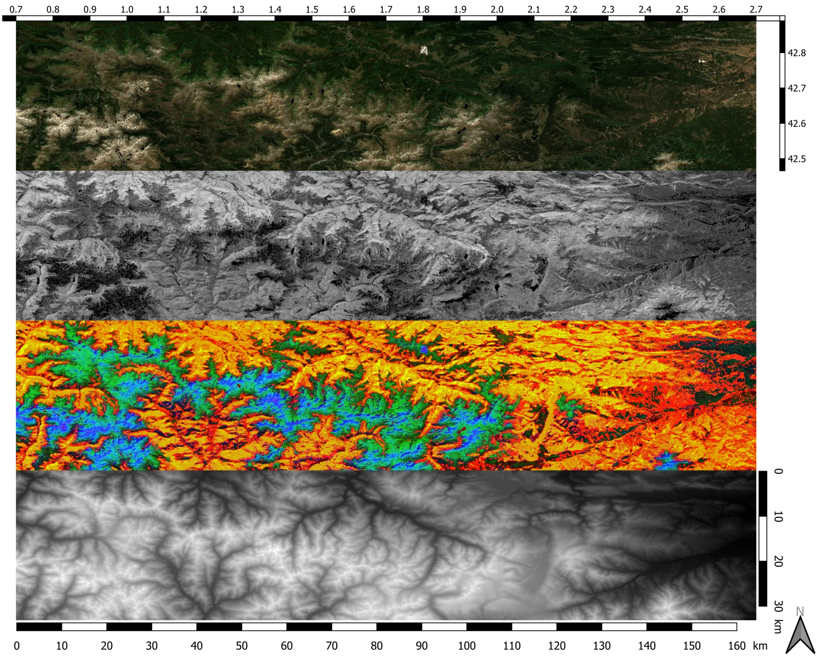
Image: Study area in the Pyrenees (between France and Catalonia, with Andorra in the middle). From top to bottom: optical image, vegetation height, land cover map and terrain elevation.
In recent years, the use of Earth observation (EO) data has been increasing, mainly due to climate change and all the use cases arising from it. These include agricultural and forestry monitoring, fires, droughts, floods and river floods, coastal monitoring, ground movements, earthquakes and analysis of affected areas. All this requires a great capacity for data processing and tools to obtain useful information quickly and efficiently; this is where artificial intelligence (AI) tools come into play. In response to this need, the AI4EO (Artificial Intelligence for Earth Observation) project was born. Today, AI is applied in virtually all sectors, from medicine and finance to human resources and telephony, because it allows us to interpret data in a simple way and extract patterns and relevant information.
In the EO world, the use of these AI tools is straightforward, due to the large amount of data and the complexity of processing and analysis. In this context, IEEC research groups started working to map the Catalan public and private ecosystem working on AI4EO. In this way, they have catalogued which activities are being carried out, by which actors, and how they are evolving, and were able to assess the prospects for the use of these technologies in our ecosystem.
Work has now begun on specific projects and use cases, where these technologies can provide relevant information on the Catalan territory. The first of these use cases is a study to estimate and study the evolution of biomass in forest areas.
Acknowledegements: This project has been carried out within the framework of the NewSpace Strategy of Catalonia, promoted by the Government of Catalonia.
TEAM
With the support of