
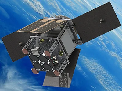
HydroGNSS


Small European satellite that will measure key hydrological climate variables
HydroGNSS will measure soil moisture, the freezing state over permafrost and other variables to monitor climate change and plan preventive measures. It is the European Space Agency's first Scout mission, a programme for testing new technologies quickly and at low cost.
Led by UK-based Surrey Satellite Technology Ltd., the HydroGNSS mission will provide measurements of key hydrological climate variables, such as soil moisture, freeze-thaw state over permafrost, floods, wetlands, and above-ground biomass, using GNSS (Global Navigation Satellite System) reflectrometry. These variables help scientists understand climate change and contribute to weather modelling, ecological mapping, agricultural planning, and flood preparedness.
HydroGNSS is the first mission of the European Space Agency's (ESA) Scout Programme, which aims to demonstrate the important role that small satellites (with a lean budget of 35 million euros and a three-year schedule) can play in Earth Observation. HydroGNSS complements other agency missions, such as SMOS and Biomass.
The HydroGNSS mission paves the way towards a future constellation of small satellites that can provide measurements with a spatio-temporal resolution that is not accessible to traditional remote sensing satellites. This would provide a new tool for monitoring highly dynamic phenomena and help fill gaps in our monitoring of the Earth's vital signals in the future.
THE IEEC CONTRIBUTION
The IEEC Earth Observation researchers are involved in HydroGNSS as part of the mission consortium. The IEEC's responsibilities in the HydroGNSS mission are to contribute to the end-to-end simulator; to define and exploit a new mode of operation of the on-board receiver called coherent channel; to develop the official ground segment algorithms for coherence and water detection in floods and wetlands; as well as to develop the entire code package for ground processing of the downloaded sampling data in the crudest possible way: data sampled and downloaded to the ground without intervention of the on-board receiver reception algorithms.