Research projects
Data Fusion for High-Resolution Soil Moisture Estimation (DATAFUS)

Regular soil moisture maps to optimise water resources and crops
The project aims to develop an operational high-resolution soil moisture product that overcomes the limitations of maps derived from passive satellites, which traditionally have resolutions of around 40 km. Through machine learning techniques and the use of multiple data sources, the project seeks to improve the accuracy and operational scope of soil moisture maps. The resulting product will enable practical applications in water resource management, precision agriculture, environmental monitoring and natural disaster prevention, thereby contributing to better adaptation to climate change and data-driven decision-making.
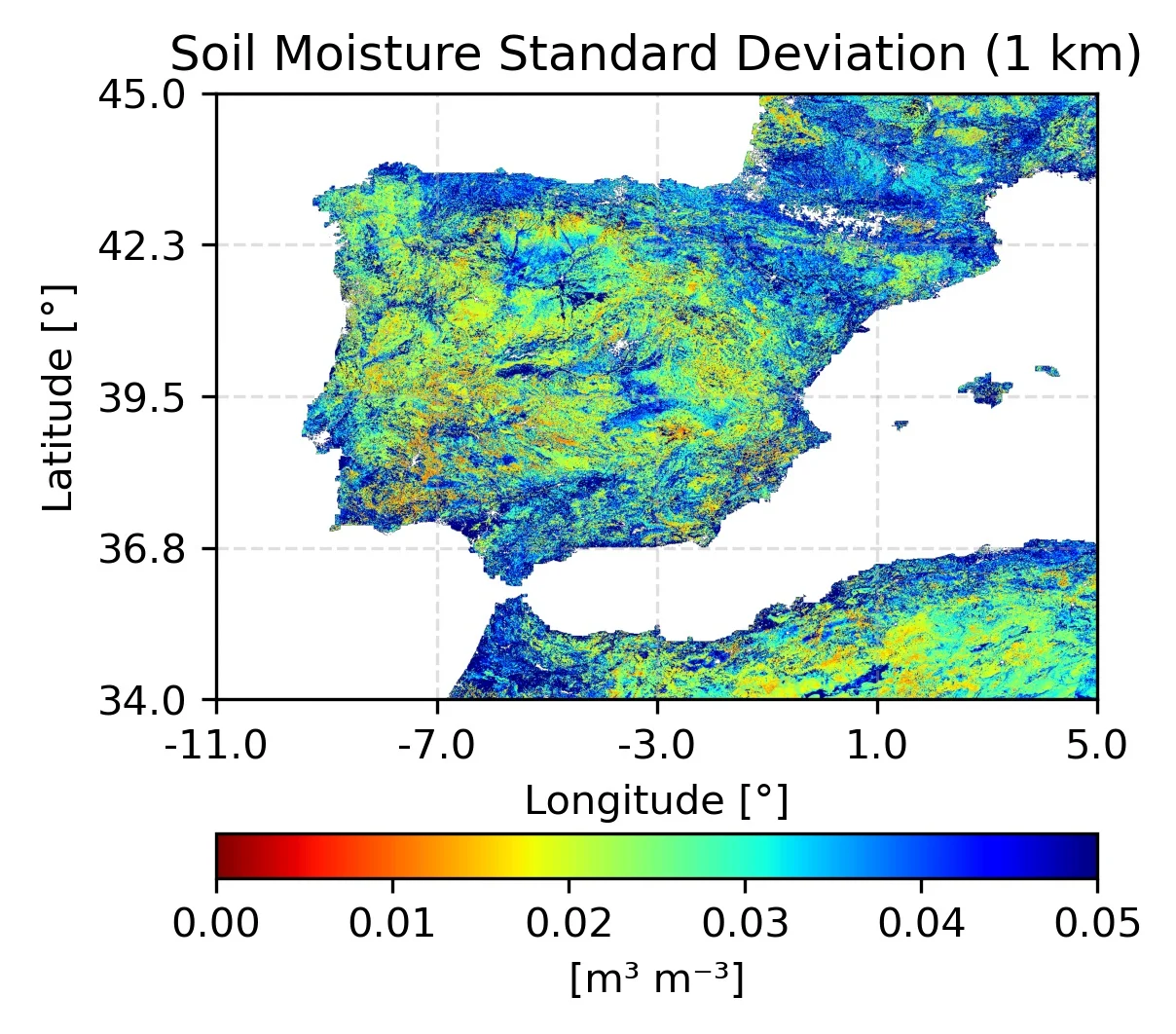
Image: Standard deviation of soil moisture at 1 km for 5 May 2019.
Soil moisture (SM) is considered an essential climate variable due to its direct impact on the climate, the monitoring of natural disasters, weather forecasting, agricultural productivity and water resource management. This project focuses on the development of a machine learning methodology for estimating soil moisture (SM) at high resolution (≤ 1 km).
The aim of the IEEC group at the Universitat Politècnica de Catalunya (UPC) is to overcome a key limitation of passive microwave remote sensing: SM maps, with spatial resolutions of around 40 km, do not provide the detail required for specific local applications, such as precise water management in agriculture.
The technology uses a multisensor feedforward neural network, based on different data sources, to capture the relationships between the predictors and the SM. The target variable for the model is the SM of the Climate Change Initiative (CCI) product from the European Space Agency (ESA). The predictors include diverse information: spectral bands and indices from Sentinel-2, MODIS land surface temperature, topographic data such as elevation and slope from the SRTM mission, precipitation and evapotranspiration from ERA5-Land, and soil texture from SoilGrids250m.
Currently, the project's objective is to minimise temporal and spatial gaps in the high-resolution moisture maps as much as possible, in order to create a more reliable and operational product.
Acknowledgements: This project has been carried out within the framework of the NewSpace Strategy of Catalonia, promoted by the Government of Catalonia.
TEAM
With the support of